Powerful Equipment
Quality Guaranteed
Affordable Prices
Professional Team
Responsiveness
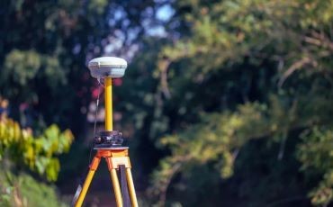
Geodetic Surveys
Establishing large area control network surveys. Precise levelling and establishing Benchmarks
01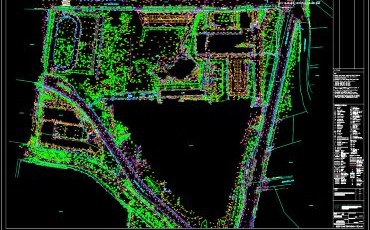
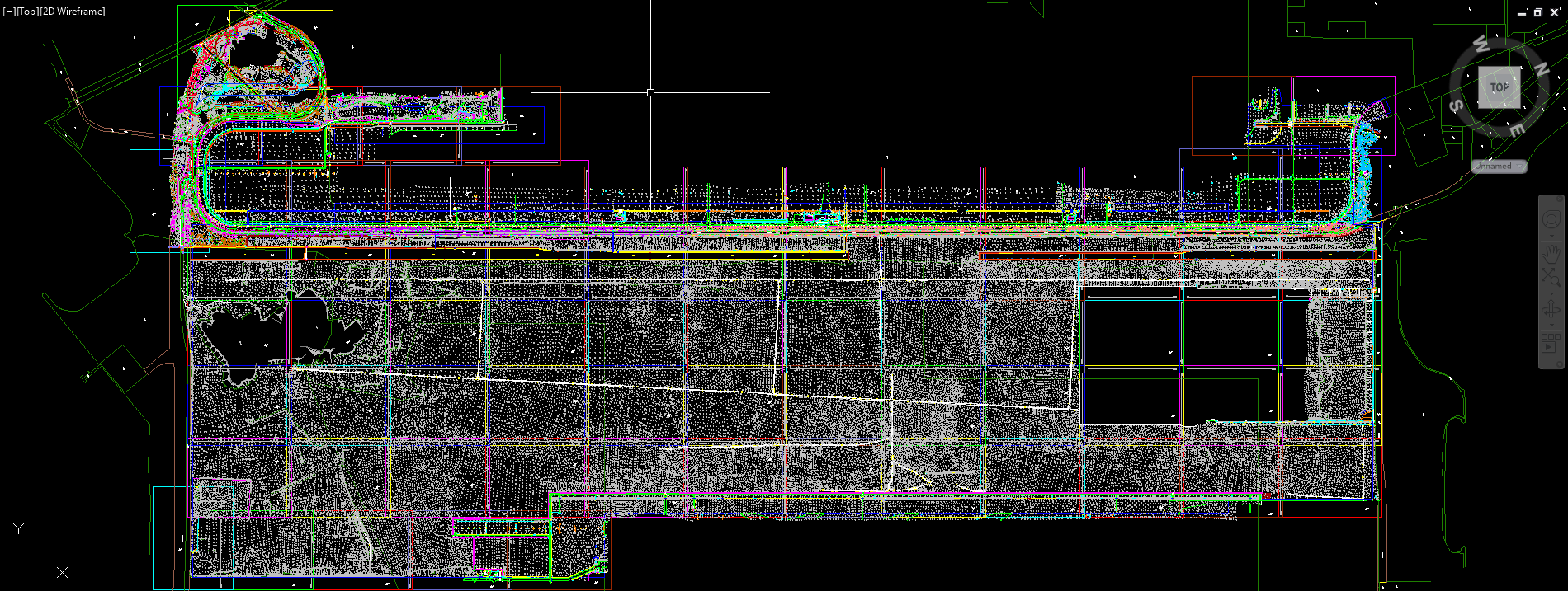
Topographical Surveys
A topographical survey maps land features, elevations, and contours to provide a detailed 3D site representation.
02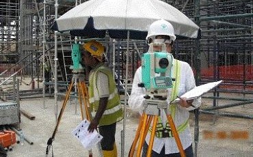
Engineering Surveys
Engineering surveying involves precise surveys to plan, design, and accurately position infrastructure during construction projects.
03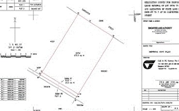
Cadastral Surveys
A cadastral survey in Singapore defines legal property boundaries and land ownership for official title registration.
04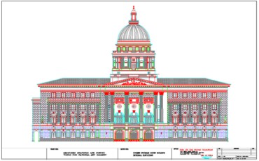
Measured Surveys
A building measured survey records precise internal and external dimensions to create accurate floor plans ,sections and elevations.
05
Monitoring Surveys
A monitoring survey tracks structural or ground movement over time to ensure safety and stability.
06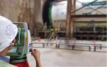
Tunnel Surveys
A tunnel survey provides precise underground alignment and guidance to ensure two excavation faces meet accurately.
07
Hydrographic Surveys
A hydrographic survey maps underwater terrain, depth, and physical features to ensure safe maritime navigation.
08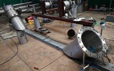
Dimensional Surveys
A dimensional survey provides high-precision measurements of objects to ensure perfect fit and alignment during fabrication.
09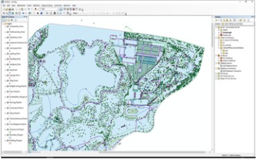
GIS Surveys
GIS is a computer system that captures, stores, analyzes, and displays geographically referenced spatial data.
10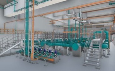
3D SCANNING & BIM
3D laser scanning captures physical shapes into point clouds to create accurate digital 3D models.
11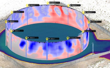
Special Surveys
To provide Volume survey,Gazette survey, Flatness/levelness survey and UAV survey
12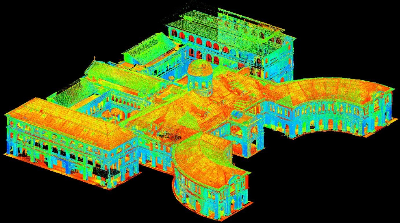
Singapore Art Museum (SAM)

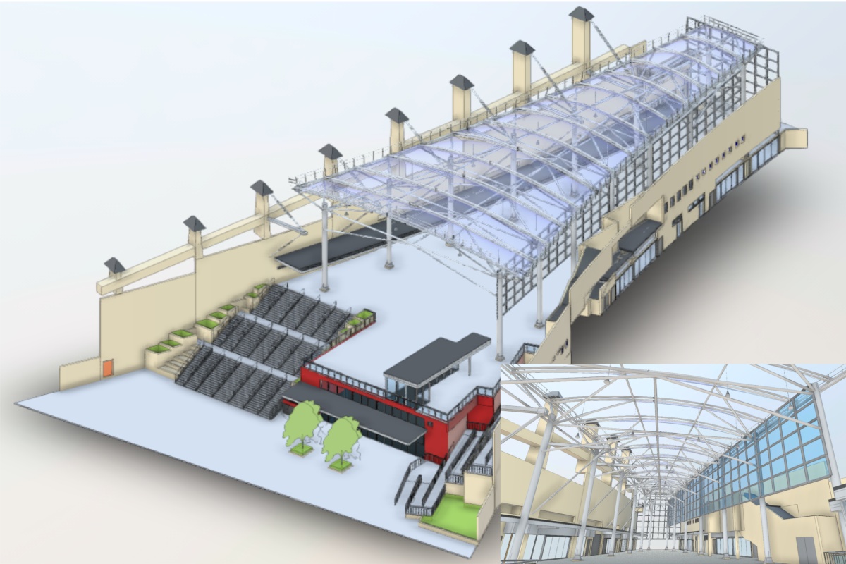
Singapore KTM Station
CHANGI AIRPORT T5

BOTANIC GARDENS
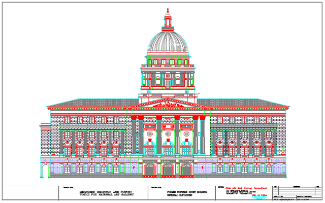
CITY HALL
Sands Expo & Convention Centre
Marinabay Sands Hotel
Choa Chu Kang Sport Centre
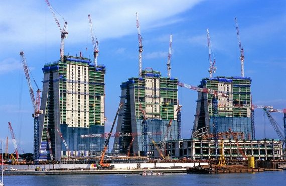
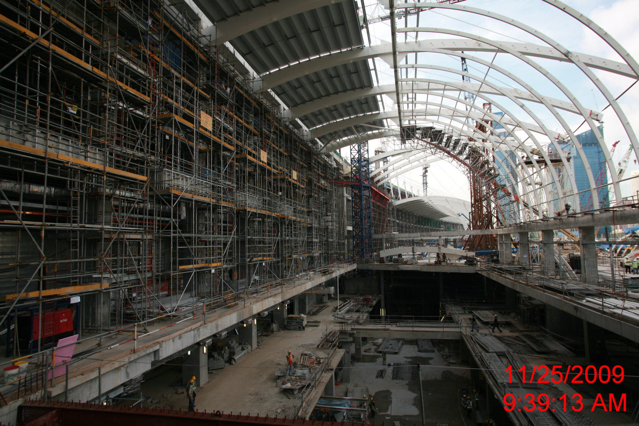
Marina Bay Sands 2008
Singapore
Our company was deeply involved in the construction of this project, providing rapid and accurate surveying and mapping services to numerous contractors.
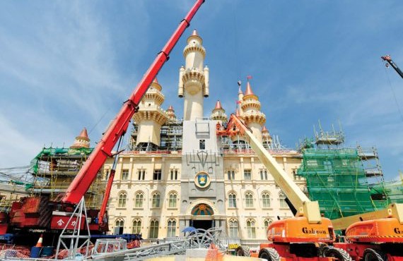
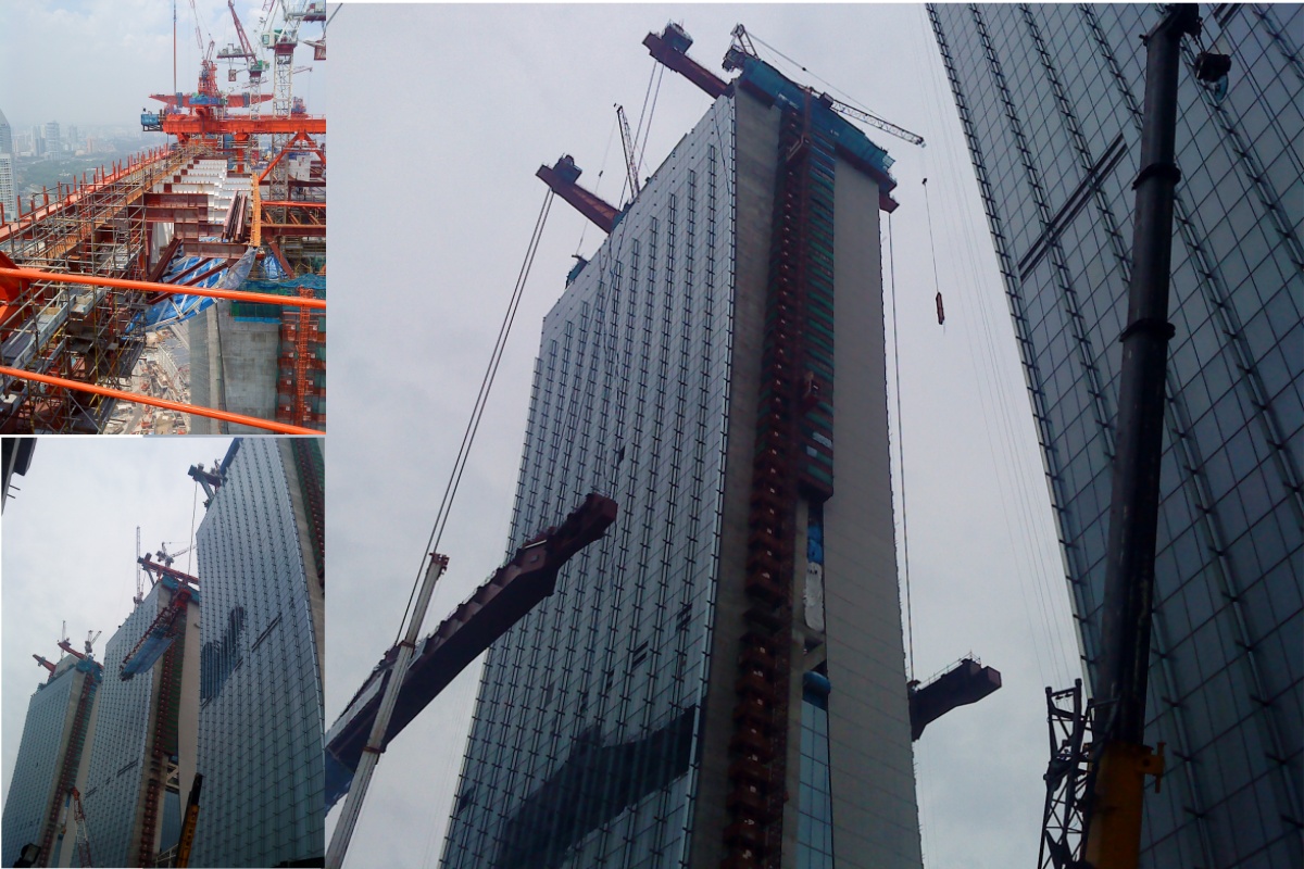
Resorts World Sentosa (RWS) 2007-2010
Singapore
Our company was deeply involved in the construction of this project, providing rapid and accurate surveying and mapping services to numerous contractors.
13025
projects
15
awards won
24
partners
15
new clients