
Geodetic Surveys
- Control Network Survey
- Leveling and Benchmarks
- GPS Survey
- Control Network Survey
- Leveling and Benchmarks
- GPS Survey
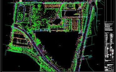
- Detail and Feature Survey
- Contour and Thematic Mapping

- Pre-computation
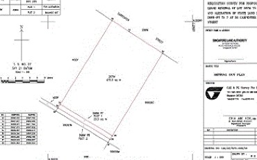
- Setting Out Survey
- As-built Survey
- Alienation of State Land
- Land Subdivision & Amalgamation
- Strata Subdivision
- Resurvey of Lot
- Foreshore Land Survey
- GFA Survey
- NLA Survey
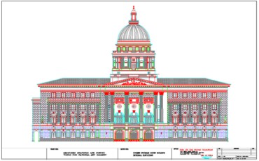
- Floor Plan
- Elevation & Section

- Ground Settlement
- Existing Structure Monitoring
- Designing buildings of all kinds

- Wriggle Survey
- Geometry Survey

- Charting and Mapping
- Reclamation Surveys
Dimensional Control
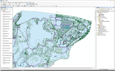
- GIS for NPARK
- GIS for LTA
- GIS for HDB

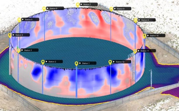
- High Definition Scanning
- 3D Point Cloud
- BIM
- Volumes Survey
- Gazette Survey
- Flatness/Levelnes
- UAV
Sign up to our newsletter and follow us on social media